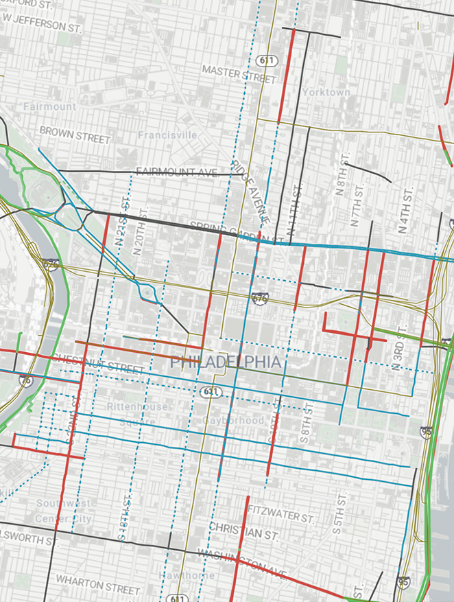
In 2008, Philadelphia had 205 miles of bicycle lanes. By 2021, that had expanded to nearly 300 miles of bike lanes across the city. But most of those, even today, are nothing more than a stripe of paint — and as John Boyle, research director for the Bicycle Coalition points out, “paint isn’t protection.”
With this growth in the city’s bike infrastructure, activists are focusing on quality over quantity, emphasizing the need for protected lanes and targeting the city’s most dangerous and highly-traveled corridors for new infrastructure and improvements.
“OTIS (Office of Transportation and Infrastructure Systems) have started to actually take seriously the idea that we need protected bike lanes, protected infrastructure, which is a great sign,” says David Talone, an organizer with Philly Bike Action!.
Bike lanes that are protected with concrete barriers or are separated from moving traffic by parking are the safest, Talone says. Still, the bike lanes on Spruce and Pine streets, proposed in 2008, which kicked off what Boyle calls a “pivot” for the city’s bike infrastructure, are separated from traffic by nothing but a few flex posts at intersections.
For riders looking to make cross-town trips using bike lanes, and to use protected infrastructure as much as they can, the gaps are beginning to close, Boyle says.
One such gap is for those traveling from West Philly into Center City and beyond. Walnut and Chestnut streets now have parking protected bike lanes stretching from 63rd to 22nd Street, including a recently-protected section on the Walnut Street bridge.
To continue east, riders can follow an almost continuous route to the Delaware River: From Walnut, take 22nd to Market Street, then turn east and follow the newly painted bike lanes on the south and east sides of City Hall to 13th Street (though cyclists have complained on Reddit that the lanes are often blocked by parked police cars). These City Hall bike lanes are currently a pilot, with City legislation needed in the next six months to make the lanes permanent.
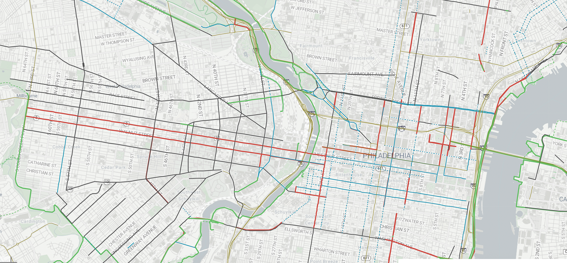
The next available bike lane heading east begins on Race Street at 8th Street, where a rider can continue onto the Benjamin Franklin Bridge or the Delaware River Trail, which stretches to Penn Treaty Park in the north and Washington Avenue in the south. But south of Race Street, Boyle says, Spruce and Pine streets’ continuous bike lanes are most riders’ best bet for east-west trips.
In South Philly, the Christian to Crescent segment of the Schuylkill River Trail, opened in May of 2025, has offered riders in Grays Ferry a new route to Center City and other parts of the city. This route is set to extend this year, with the soon-to-be completed swing bridge connecting the Grays Ferry trail to the Bartram’s Mile Trail across the Schuylkill River.
Much of Washington Avenue still has standard painted bike lanes, except for protected lanes on 11th to 4th streets, which are set to be extended east to connect to the Delaware River Trail. “I think the data that the city has shown already shows that it’s much safer to be on the east side than the west side. And it’ll be a continuing effort to complete that gap,” Boyle says.
For riders looking to make safe cross-town trips north or south, Talone recommends off-road routes like the Delaware River Trail and the Schuylkill River Trail, calling the latter “the gold standard.” But he adds that despite the safety of these trails, there are plenty of green spaces in the city where bicyclists are at risk, including Fairmount Park.
“Belmont Avenue and Montgomery Avenue and Kelly Drive are all on the High Injury Network,” Talone says. “Our parks should be safe places for people that ride their bikes. They shouldn’t be afraid of getting run down by a car at a park.”
Talone and his fellow organizers with Philly Bike Action! want to see the bike lanes expand to become more of a true network of bikeways. “Right now, we have a patchwork quilt,” he says.
But if the city had the infrastructure in 2008 that it has now, Boyle says riders of the time would have been amazed. “There would be more of us around. I think we would have saved lots of lives.”
A Look Back

Notes from Publisher Alex Mulcahy
Biking in Center City in 2008 felt like the urban equivalent of running with the bulls. Swerving from one lane to another, or between lanes, required a sense of invincibility. I now hew more closely to the advice we gave back then: wear a helmet and reflective gear, and put lights on your bike. Looking back at the map of bike lanes we published at that time, it’s encouraging to see how much infrastructure has been added. My daily commute from West Philly to Chinatown is greatly improved. Now let’s get those lanes protected!


Hey, no mention of the new raised bike lanes on East Market! I often ride 11th to 2nd on Market. Actually there is very low traffic and I feel safe in the street. The new raised path is crazy because the intersection ramps don’t always lineup and there are often people standing and walking in them. Maybe signage would help that.