
Blazing a Trail
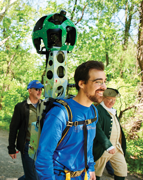
The nooks and crannies of Fairmount Park will soon be documented in the same detail as the Street View tab on Google Maps. The tech giant has lent the city one of its Street View Trekker backpacks, a 50-pound, 15-lens camera system that looks like a robotic lollipop and will take a constant stream of panoramic snapshots as hikers collect information on 200 miles of trails.
Close-ups of the historical houses and public art pieces within the park will also be included in the undertaking, organized by Fairmount Park Conservancy and Parks and Recreation.
“We made an ambitious plan to cover as much area as we can,” said Tim Clair, interim executive director of the conservancy. “We wanted to capture areas of the city even longtime Philadelphians may not realize exist.”
The city is expected to launch the new footage publicly in 2017.


OUTSTANDING article on such a marvelous tool (googlemaps). Thanks for the good news.